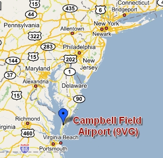
Campbell Field Airport
9114 Bayford Road
Weirwood VA 23413
Office (757) 442-7519
Fuel available at Accomack County
Airport (13nm North East).
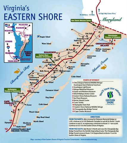
Courtesy Car: Flying in and want to explore the shore?
Campbell Field Airport is the only airport on the ESVA with a
courtesy car. Please print and complete the Courtesy Car Agreement
and leave it with us prior to using the car. The keys to the
courtesy car are located in the Pilot's Pub. The four digit
combination to the pilot's pub is the CTAF. The only thing we ask
of the driver is that they replace the fuel used.
Camping is allowed
anytime. There are wooded and open areas to camp. No
facilities unless the office is open.
What
to do after you land?
Scroll the map and click on icons for ideas.
View Larger Map
Additional
Information Pages:
Courtesy Car Agreement
Camping Information
Restaurants, Hotels & Nearby
Attractions
Notice:
All aeronautical and other activities at Campbell Field Airport are
recreational in nature and no payment is ever required for use of the
premises. In compliance with Virginia Code Section 29.1-509 the
landowner shall owe no duty of care to keep land or premises safe for
entry or use by others.
Campbell Field Airport is to be used at your own risk.
Click
here for current aeronautical charts of 9VG or any airport.
Location
| FAA Identifier: | 9VG |
| Lat/Long: | 37-27-30.4860N / 075-52-43.7510W 37-27.508100N / 075-52.729183W 37.4584683 / -75.8788197 (estimated) |
| Elevation: | 40 ft. / 12 m (estimated) |
| Variation: | 10W (1985) |
| Zip code: | 23413 |
Airport Operations
| Airport use: | Open to the public |
| Sectional chart: | WASHINGTON |
| Control tower: | no |
| ARTCC: | WASHINGTON CENTER |
| FSS: | LEESBURG FLIGHT SERVICE STATION [1-800-WX-BRIEF] |
| NOTAMs facility: | DCA (NOTAM-D service available) |
| Attendance: | MAR-NOV DAYLIGHT HOURS, DEC-FEB IREG |
| Wind indicator: | yes |
| Segmented circle: | no |
Airport Communications
| CTAF: | 122.8 |
| WX AWOS-3 at MFV (13 nm NE): | 118.175 (757-787-5660) |
Nearby radio navigation aids
| VOR radial/distance | VOR name | Freq | Var | |||
|---|---|---|---|---|---|---|
| CCVr050/8.7 | CAPE CHARLES VORTAC | 112.20 | 10W | |||
| ORFr031/37.3 | NORFOLK VORTAC | 116.90 | 07W | |||
| HCMr096/39.7 | HARCUM VORTAC | 108.80 | 07W |
| NDB name | Hdg/Dist | Freq | Var | ID | |||||
|---|---|---|---|---|---|---|---|---|---|
| ACCOMACK | 221/7.7 | 336 | 11W | BDB | -... -.. -... | ||||
| HENRY | 065/35.2 | 375 | 09W | PJS | .--. .--- ... | ||||
Runway Information
Runway
3/21
Notam:
Power line, 60ft AGL 300 Ft. South of RWY 3 Courtesy of A&N
Electric Cooperative. Power line is well marked with orange balls.
Effective landing distance RWY 3 is 2200ft.
| Dimensions: | 3000 x 125 ft. / 914 x 30 m | ||
| Surface: | turf, in good condition | ||
| RUNWAY 3 | RUNWAY 21 | ||
| Traffic pattern: | left | left | |
| Obstructions: | Powe line, 60ft AGL, 300 ft. from
runway. Effective landing distance RWY 3, 2200ft. |
15 ft. road, 25 ft. from runway, 1:1 slope to clear | |
Runway 14/32
| Dimensions: | 1455 x 100 ft. / 443 x 43 m | ||
| Surface: | turf, in good condition | ||
| RUNWAY 14 | RUNWAY 32 | ||
| Traffic pattern: | left | left | |
| Obstructions: | 15 ft. road, 20 ft. from runway, 1:1 slope to clear | 53 ft. trees, 555 ft. from runway, 19 ft. left of centerline, 10:1 slope to clear | |